Home > Key Stage Two > History > Iron Age
Lesson Three – Hill Forts

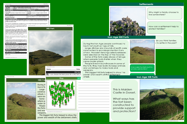
This history teaching pack for Key Stage Two gets the children to practise using maps to identify and select the best location for the construction of an Iron Age settlement in the past to support the community.
The class can select and record a list of reasons as to why a specific location would be a suitable location for a settlement for an Iron Age tribe such as protection from attack and proximity to natural resources.
Download this teaching pack including a lesson plan, classroom activities and an interactive presentation to practise using maps to identify and select the best location for the construction of an Iron Age settlement in the past to support the community
Activities in this teaching pack include display posters to identify and describe how Iron Age tribes built settlements in the past, a shared reading text to explain how and why Iron Age tribes built settlements in the past and a template to select and record reasons for the location of an Iron Age hill fort in the past,
The interactive presentation can be used to explore how to use maps to identify and select the best location for the construction of an Iron Age settlement in the past.
This lesson is part of a history scheme of work to get the children to investigate how Britain developed and changed during the Iron Age by exploring how historians find out about the past using primary sources including archaeology. There are teaching activities for shared learning, differentiated worksheets to support independent learning and interactive presentations to introduce concepts and key skills.
-

Future World
Practise using apostrophes correctly in matching sentences to describe some of the things that might be owned by families in the future
-

Recycling Bin
Select, format and adjust the properties of different shapes when creating the graphic design for a recycling bin for use in school classrooms
-

Space Helmets
Select, shape and combine different mouldable materials to make a model of an astronaut’s helmet that could be worn when exploring space
-

Division Remainders
Explain and model how to solve contextual and abstract problems when dividing two and three digit numbers by single digit numbers with remainders
